|
Learning Goals: Students will understand... ...physical and political boundaries of the United States. ...how to use maps to explain physical and cultural attributes of major regions throughout American history. ...how to use appropriate geographic tools and terms to identify and describe significant places and regions in American history. Thurs/Fri, August 23 & 24, 2018 HW due:
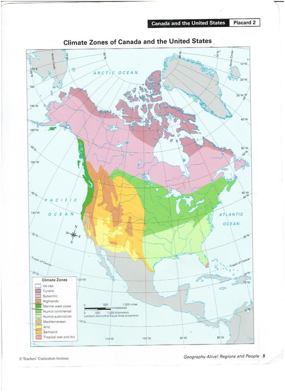
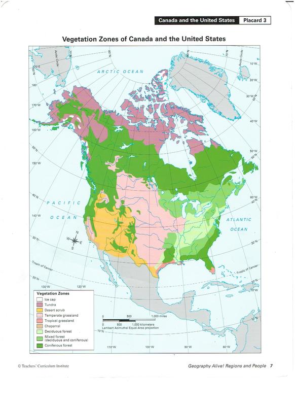
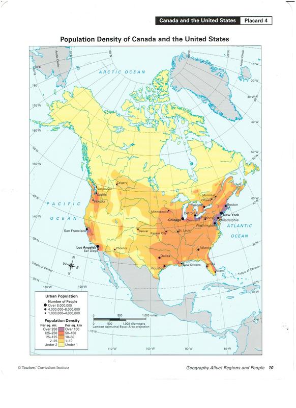
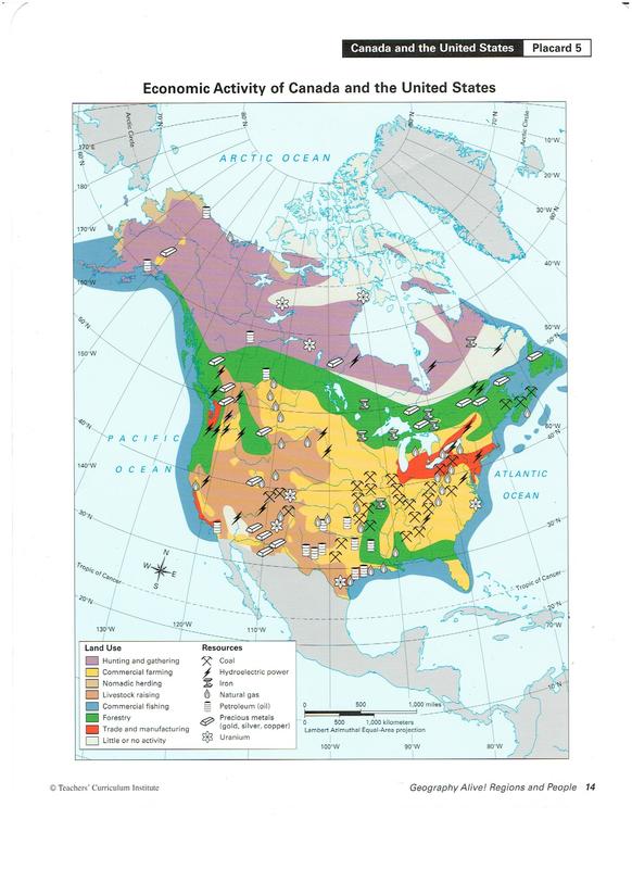
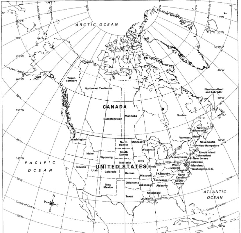
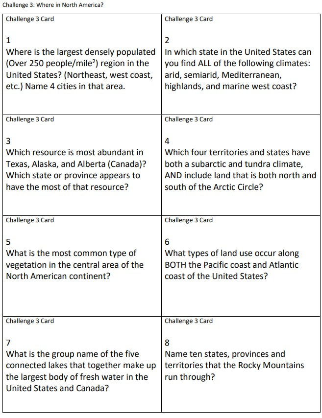
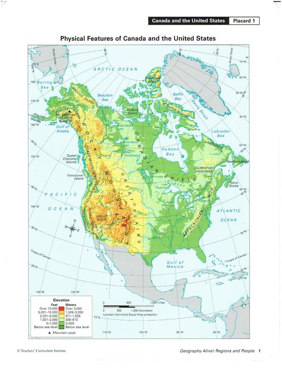
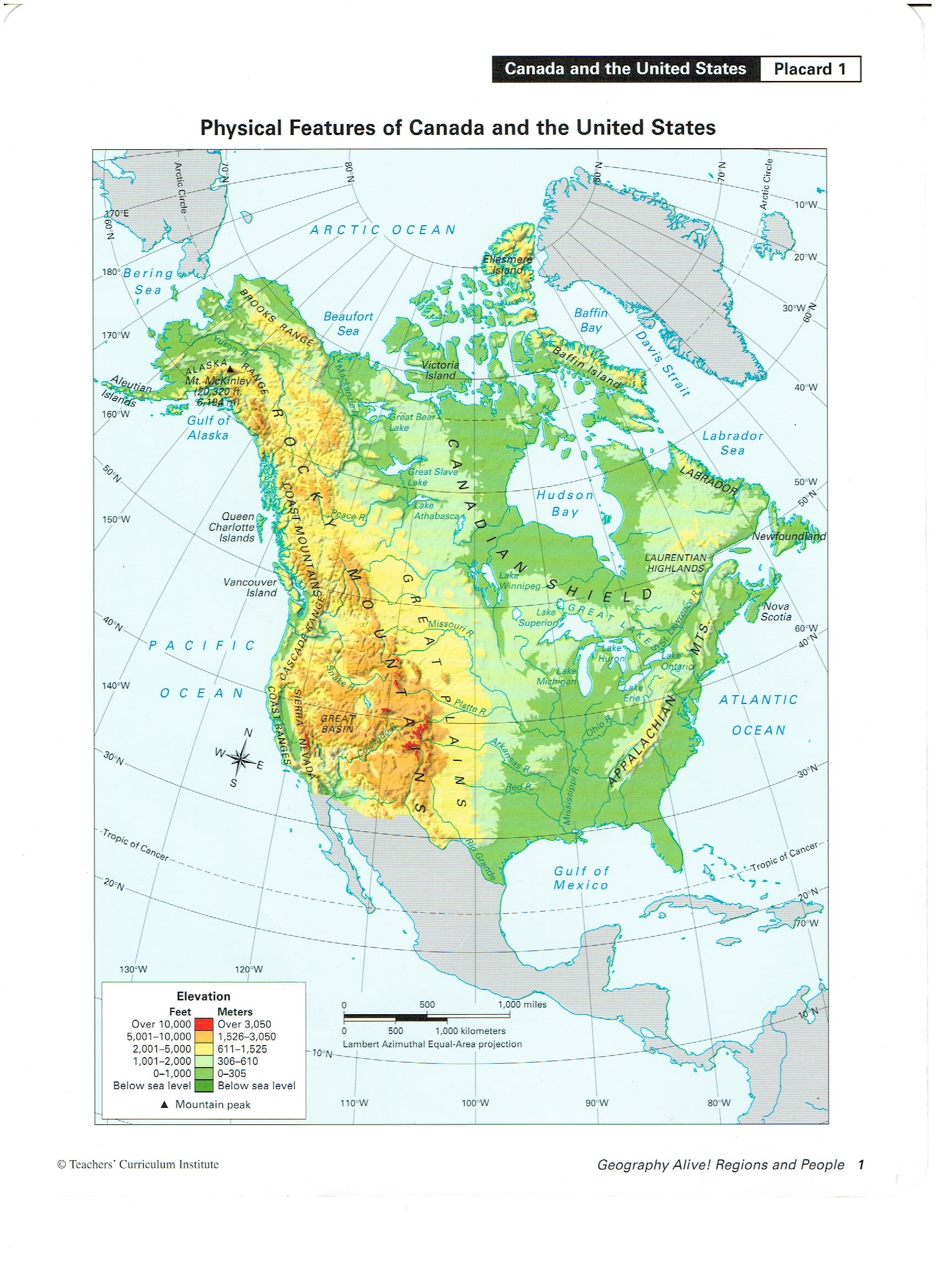
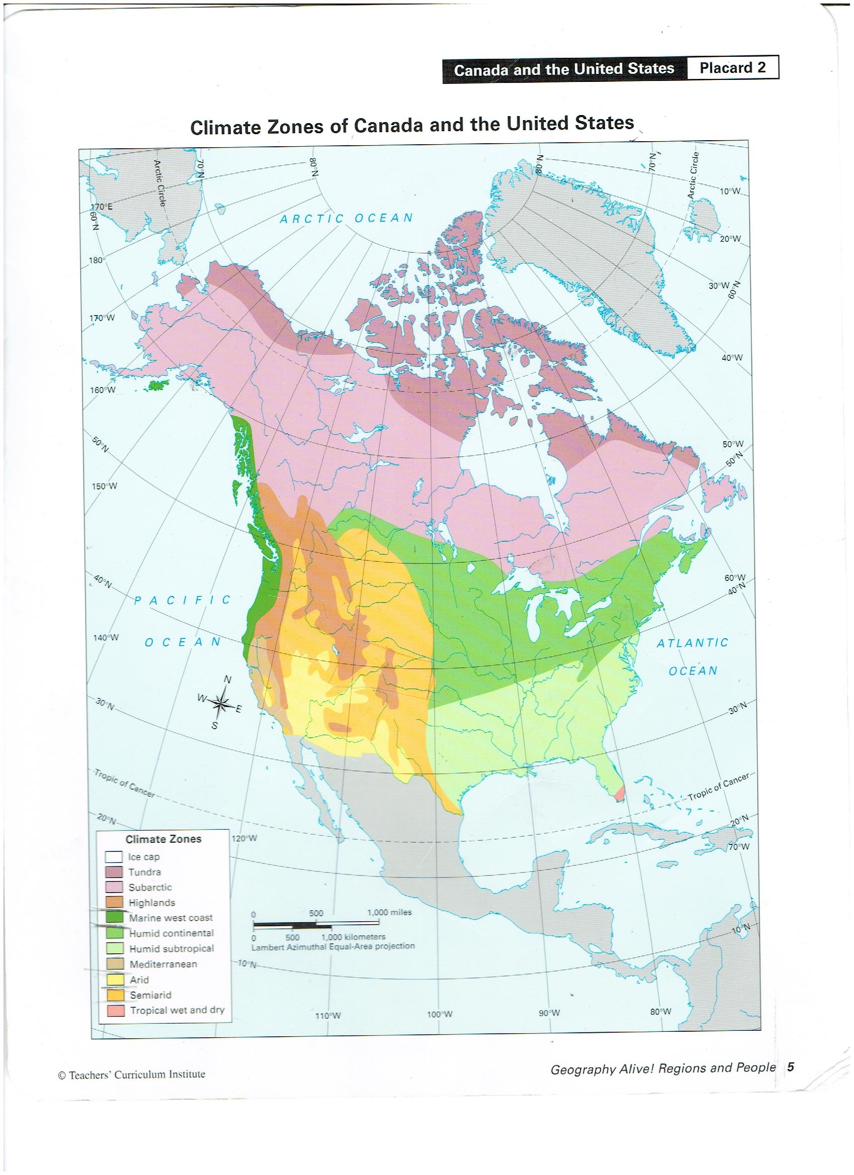
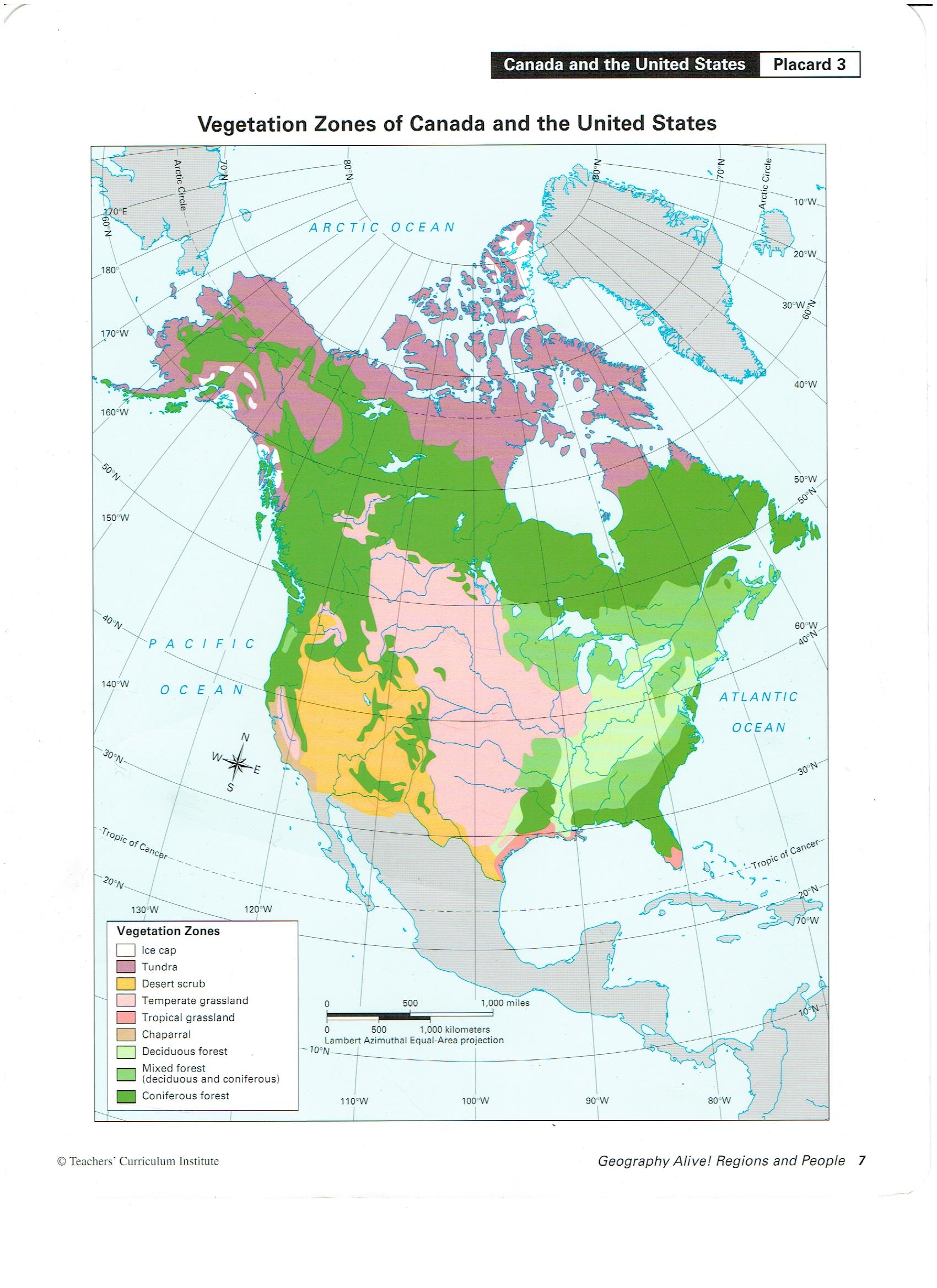
1. North America Mapping Lab Challenge 3: "Where in North America?" #3 *On notebook paper: label your name, date, period, #3. Title: Challenge 3: Where in North America? *Draw lines across your paper to create 4 sections on the front and 4 on the back. •About every 6-7 lines *For each of the 8 question cards: (also see image below) •Identify the map type used to answer the question. (placard, see images below or attached here: Physical, Climate, Vegetation, Population Density, Economic Resources) •You also might need to use the political map to find the answer. •Write the answer in a complete sentence in the box for that question number on your notebook paper. • Repeat 7 more times. Finish for HW. Tues/Wed, August 21 & 22, 2018 1. Primary Source Evidence of a Summer Adventure: Share
Comments are closed.
|
AuthorMs. Day is a U.S. History teacher at Milwee Middle. She loves the Florida Gators, social studies, historical fiction novels, Hamilton, Disney,Harry Potter, kitties, and, most of all, students who try their best. Archives
May 2019
Categories |


 RSS Feed
